


Malta Twp. Voting District, Big Stone County, Minnesota
About
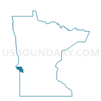
Outline

Summary
| Unique Area Identifier | 601217 |
| Name | Malta Twp. Voting District |
| County | Big Stone County |
| State | Minnesota |
| Area (square miles) | 37.15 |
| Land Area (square miles) | 36.32 |
| Water Area (square miles) | 0.83 |
| % of Land Area | 97.77 |
| % of Water Area | 2.23 |
| Latitude of the Internal Point | 45.44808970 |
| Longtitude of the Internal Point | -96.31195930 |
Maps


Graphs
Select a template below for downloading or customizing gragh for Malta Twp. Voting District, Big Stone County, Minnesota


Neighbors
Neighoring Voting District (by Name) Neighboring Voting District on the Map
- Almond Twp. Voting District, Big Stone County, MN
- Artichoke Twp. Voting District, Big Stone County, MN
- Baker Twp. Voting District, Stevens County, MN
- Big Stone Twp. Voting District, Big Stone County, MN
- Graceville Twp. Voting District, Big Stone County, MN
- Moonshine Twp. Voting District, Big Stone County, MN
- Otrey Twp. Voting District, Big Stone County, MN
- Stevens Twp. Voting District, Stevens County, MN
Top 10 Neighboring County Subdivision (by Population) Neighboring County Subdivision on the Map
- Big Stone township, Big Stone County, MN (275)
- Graceville township, Big Stone County, MN (197)
- Moonshine township, Big Stone County, MN (131)
- Baker township, Stevens County, MN (114)
- Almond township, Big Stone County, MN (110)
- Malta township, Big Stone County, MN (98)
- Otrey township, Big Stone County, MN (87)
- Artichoke township, Big Stone County, MN (79)
- Stevens township, Stevens County, MN (77)
Top 10 Neighboring Unified School District (by Population) Neighboring Unified School District on the Map
- Ortonville -Bellingham Public School District, MN (3,549)
- Clinton-Graceville-Beardsley Public School District, MN (2,587)
- Chokio-Alberta Public School District, MN (1,235)